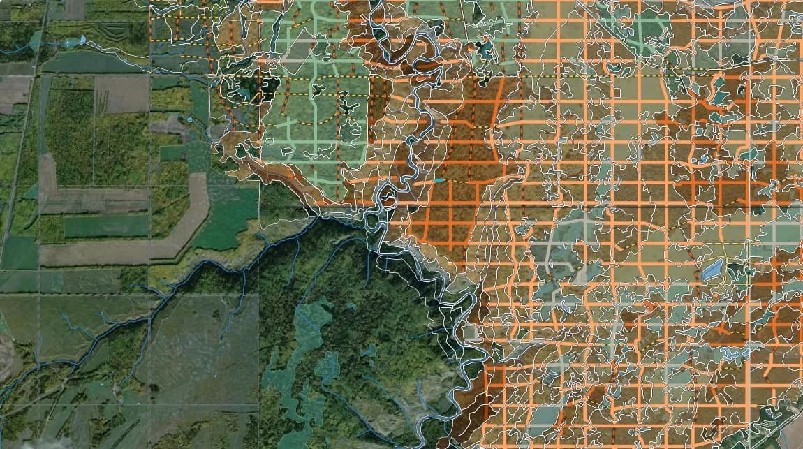
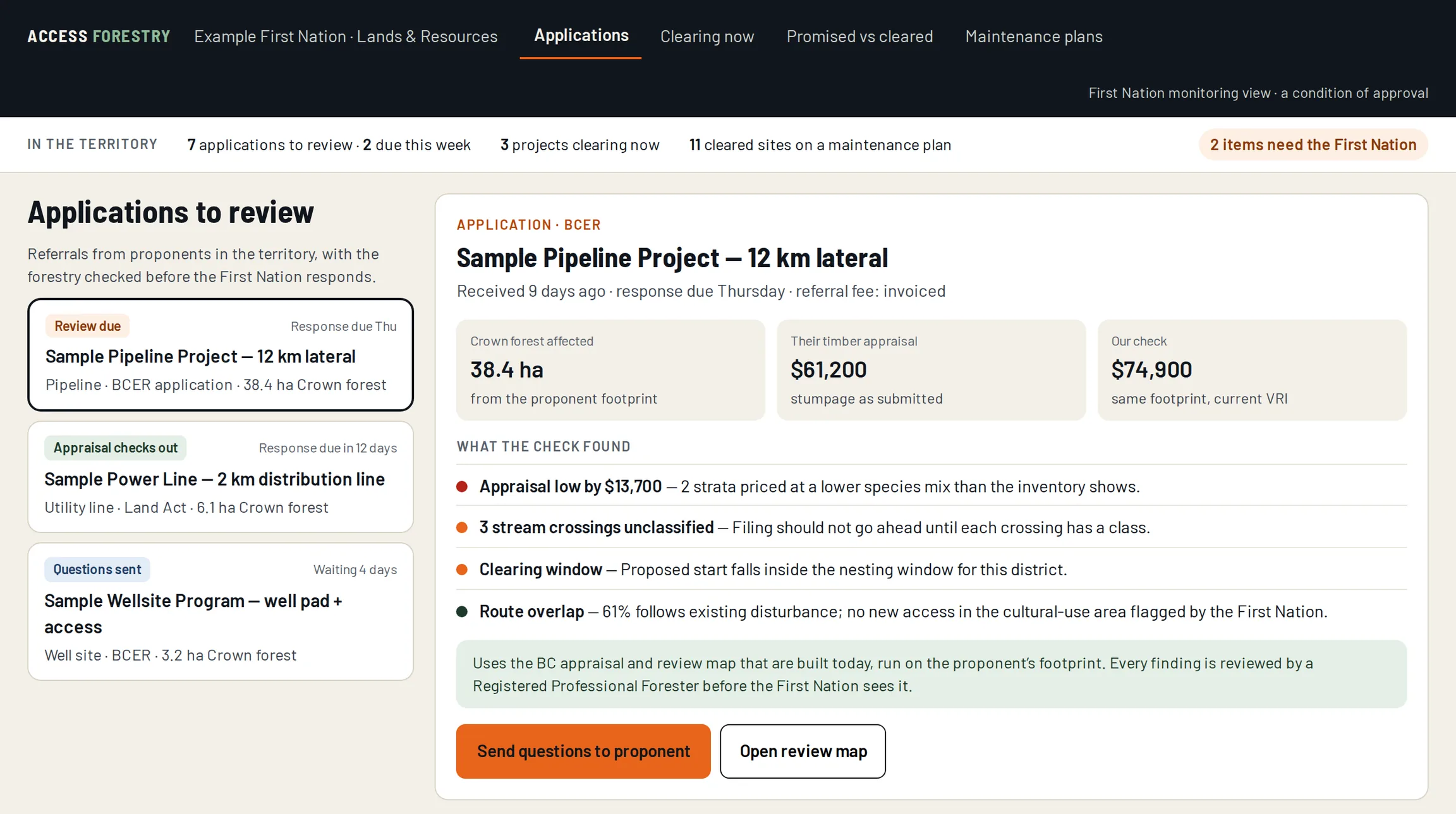
From the platform: appraisal review map. Imagery: Sentinel-2 cloudless 2016 by EOX IT Services GmbH (contains modified Copernicus Sentinel data 2016), CC BY 4.0 · Powered by Esri · Esri, Earthstar Geographics
Plan → Reclaimone platform, four offerings
RPF signedevery professional output
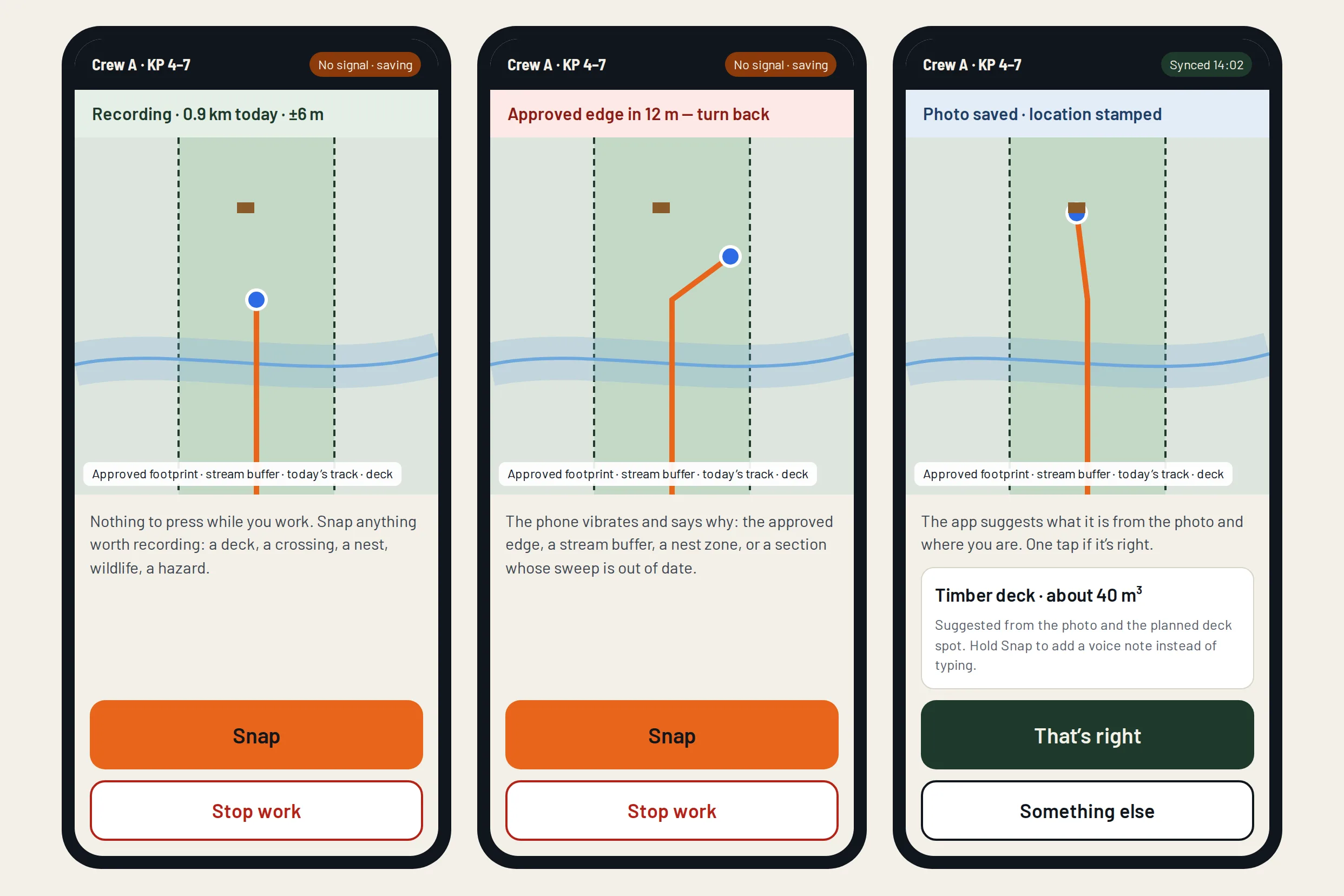
No signal neededcrews record offline
BC & AlbertaCrown forest only
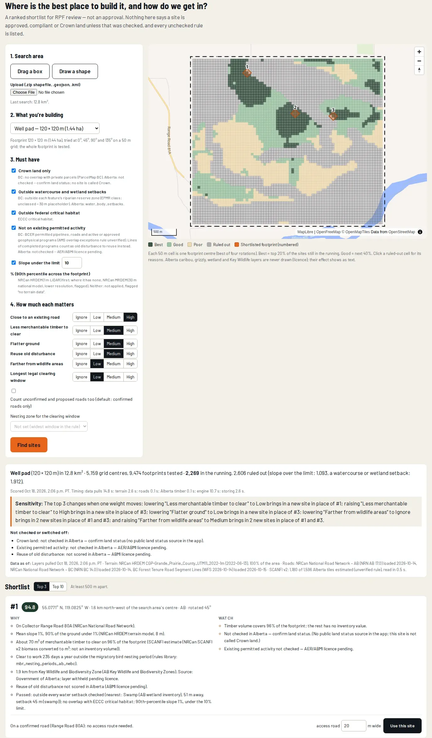
01 · SITE PLANNING
The best site and route, in minutes.
Top three options, ranked, with why — on BC and Alberta data.
Crews carry the app. It tracks where they clear and flags any clearing outside the approved area.
Sample figures
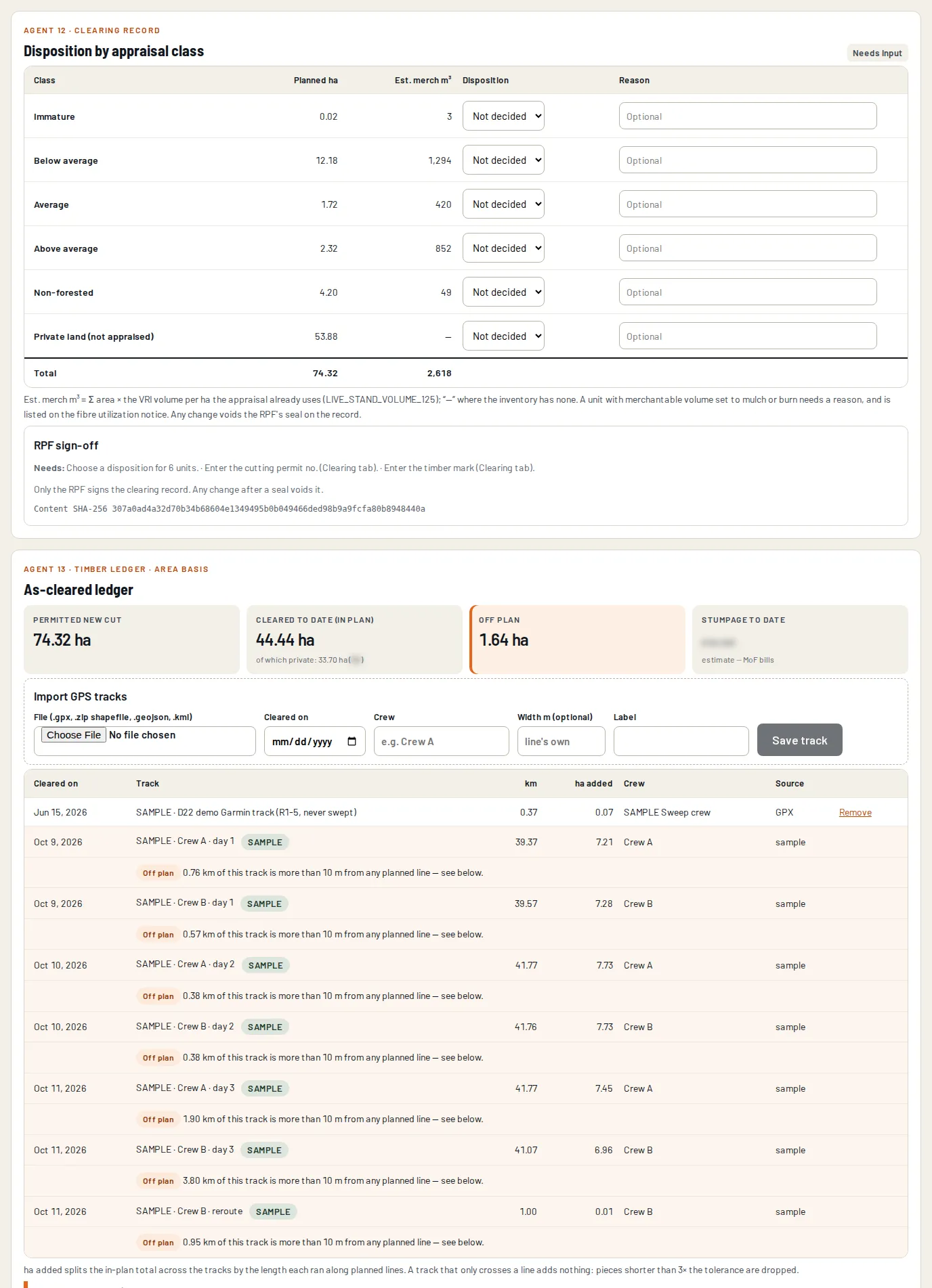
02 · TIMBER DISPOSITION
Every tree on the footprint, decided and tracked.
Mulch, deck, haul or burn — signed off, and on BC projects reconciled to the scale tickets.
From the platform · sample project
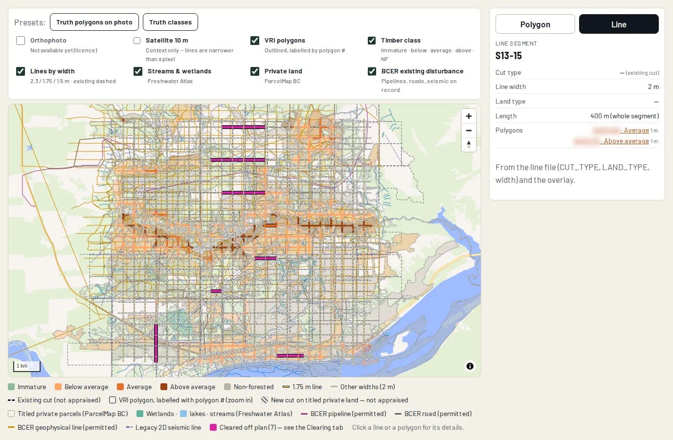
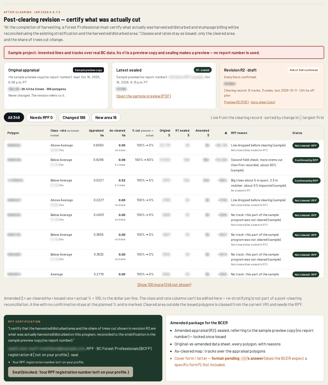
CLOSE THE LOOP
Promised. Cleared. The difference, signed.
The as-cleared footprint laid over the issued appraisal.
From the platform · sample project
03 · MULTI-YEAR SITE PROGRAM
Every site, every year, on one plan.
Vegetation management prescribed per site and right-of-way, tracked to done.How: site goal → what’s there → zones → legal methods and windows → cheapest compliant path → signed and checked.
Sample figures
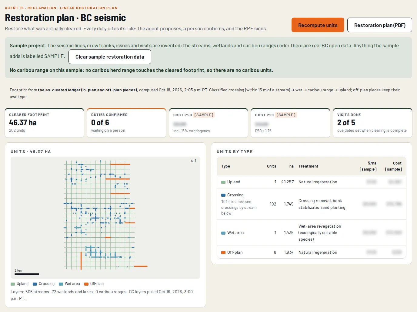
04 · FOREST RECLAMATION
Back to forest, to certificate.
Restoration plans, treatment units and visits, from the as-cleared map.
From the platform · sample project
Built for the people who deliver Crown forest work